
Page 279 - Changing Living Spaces
P. 279
The Neverlake: Water and Land Management in a Dry and Soilless Place
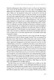
Stattschounikh genannt’; StLA, IÖHKS, K. 90, H. 14, ff. 41–73). These farms
were owned by the Špiček brothers at that time. Chronologically, this
adjustment was carried out only a few years before the draining of the
‘Lake’. There, too, the regulation works were carried out in the form of
dry stone wall construction (figure 7). The fact that the area of Stočajnik
was previously communal land is consistent with and supports the above
interpretation that the area of the ‘Lake’ was collectively used before its
draining. However, there are two notable differences. First, the goal of
water regulation in Stočajnik was to create arable land for a single family,
while the ‘Lake’ was collective property that benefited the entire commu-
nity. It is difficult to say how this affected the forms of labour; however,
it can be deduced that the community must have had a say in Stočajnik as
well, since they had given up collective use of the area. Moreover, the suc-
cessful regulation of Dol Stočajnik may have inspired a similar initiative
at the ‘Lake’. Second, as evidenced by the Franciscean Cadastre, there was
still cultivable land in the entire regulated area in Stočajnik in the early
nineteenth century.
Another similar example is the mill in the village of Rodik. The map in
the Franciscean Cadastre shows a larger channel there, accompanied by
the place names ‘Pod Jeserom’ (‘Below the Lake’) and ‘Jeseron’ (‘Lake’).
There is no lake visible, but the land is parcelled out in the shape of a lake,
which apparently disappeared in the early nineteenth century. On the
cadastral map, a reservoir is marked by the above-mentioned channel,
next to which there are two building plots. One of them bears the name
‘Stari mlin’ (Old Mill), which means that a mill once operated there. From
this we can conclude that at the time of the creation of the Franciscean
Cadastre there was less water in this area than in the more remote past.
We can find out what kind of watercourse it was from the list of plots, be-
cause the above-mentioned channel has its own cadastral number and be-
longs to the group of ‘ponds and drainage channels’ (Lach und Ableitungs
Gruben). So, the channel that starts at the reservoir next to the ‘old mill’
is a drainage or water channel, which is definitely the result of artificial
water regulation in the area once occupied by a ‘lake’ (figure 9). This old
mill is also mentioned in the folk tradition:
The Sirk House was once called Pri Malnih [At the Mills] as the Sirk
family was a family of millers. […] The Sirk family built the dam and op-
erated the mill during heavier rainfall, when the stream Pod koriti had a
stronger flow. There was no water in the summer during drought, and the
mill did not operate then. That is why the people of Rodik came up with a
277